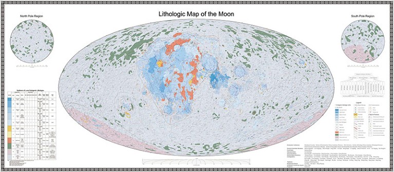
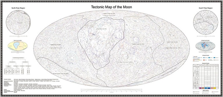
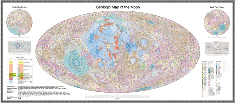
The Chinese Academy of Sciences (CAS) has released the highest-resolution geological maps of the Moon yet. The Geologic Atlas of the Lunar Globe, which took more than 100 researchers over a decade to compile, reveals a total of 12,341 craters, 81 basins and 17 rock types, along with other basic geological information about the lunar surface. The maps were made at the unprecedented scale of 1:2,500,000.
“Every question in geology starts with looking at a geological map,” says Ross Mitchell, a geophysicist at the CAS Institute of Geology and Geophysics in Beijing. The new lunar atlas is “really a resource for the whole world”, he says.
The CAS also released a book called Map Quadrangles of the Geologic Atlas of the Moon, comprising 30 sector diagrams which together form a visualization of the whole Moon.
Jianzhong Liu, a geochemist at the CAS Institute of Geochemistry in Guiyang and co-leader of the project, says that existing Moon maps date from the 1960s and 1970s. “The US Geological Survey used data from the Apollo missions to create a number of geological maps of the Moon, including a global map at the scale of 1:5,000,000 and some regional, higher-accuracy ones near the landing sites,” he says. “Since then, our knowledge of the Moon has advanced greatly, and those maps could no longer meet the needs for future lunar research and exploration.”
China will use the maps to support its lunar ambitions and Liu says that the maps will be beneficial to other countries as they undertake their own Moon missions. Three spacecraft have launched aiming for the Moon so far this year, and in May, China intends to send a craft to collect rocks from the Moon’s far side.

Scientists will use the new lunar maps to better understand the Moon's history.Credit: Chinese Academy of Sciences via Xinhua/Alamy
With the updated atlas, scientists will be able to better understand the history of the Moon, evaluate potential lunar resources and conduct comparative geological studies. It will also inform the location choices of future missions, including where to build a lunar research base, Liu says.
Carolyn van der Bogert, a planetary geologist at the University of Münster in Germany, says she was impressed by the amount of work that Chinese colleagues have put into compiling the new atlas.
“We are looking forward to being able to interact with the map in a very detailed way,” she says.
Other-worldly cartography
The atlas, which is available in both Chinese and English, was assembled using data from China’s lunar exploration programme, especially the Chang’e-1 mission, which surveyed the lunar surface from orbit between 2007 and 2009, according to Liu. “Chang’e-1’s camera conducted observation of lunar topography and geological structures, while its interference imaging spectrometer played a key role in identifying different rock types,” he says.

The new atlas was assembled using data from China's lunar exploration programme.Credit: Chinese Academy of Sciences via Xinhua/Alamy
Observations made on the Moon’s surface by the Chang’e-3 and Chang’e-4 lander missions in 2013 and 2019, respectively, helped to verify the accuracy of the Chang’e-1 data. The atlas team also used data from missions such as the Gravity Recovery and Interior Laboratory (GRAIL) and the Lunar Reconnaissance Orbiter, both launched by NASA, and India’s Chandrayaan-1 probe. “Some observations were highly complementary to the Chang’e missions. For instance, GRAIL’s data helped us identify all the deep fractures on the lunar surface,” Liu says.
Chinese researchers started to compile the maps in 2012 as they were searching for the next targets to explore on the Moon. In partnership with Russia and more than a dozen other countries and organizations, China is leading the construction of the International Lunar Research Station, which is intended to take shape in the mid-2030s at the Moon’s south pole for scientific exploration and resource exploitation.
“Contributing to lunar science is a profound way for China to assert its potential role as a scientific powerhouse in the decades to come,” says Mitchell.
Liu says that his team has already started work to improve the resolution of the maps, and will produce regional maps of higher accuracy on the basis of scientific and engineering needs. In the meantime, the completed atlas has been integrated into a cloud platform called the Digital Moon, and will eventually become available to the international research community.


 First private Moon lander touches down on lunar surface to make history
 Japan’s successful Moon landing was the most precise ever
 Strange blobs in Earth’s mantle are relics of a massive collision
 Mission failure feared for private US Moon lander — what’s next?


